Chuckanut Falls

I’m a sucker for waterfalls. There’s just something about the patterns of flowing water that draw me in. They’re not a subject that’s been lucrative but I can’t resist photographing them anyway.
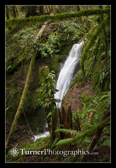
Chuckanut Falls
Chuckanut Falls

This is Chuckanut Falls, on a tributary to Chuckanut Creek in Arroyo Park just south of Bellingham. There’s a new trail, just built in the last year, leading to the falls. The falls trail takes off from the trail heading up from the Interurban Trail toward Lost Lake. The signed junction is just downhill from the top end of California Street. Continue reading

Fragrance Forest Panoramas

I continue to be drawn to Chuckanut Mountain trails for my winter hikes. Last weekend I headed up the Fragrance Lake Trail from Larrabee State Park. There’s a lookout over the bay just over a mile from the trailhead and Fragrance Lake itself is only about 2.2 miles with less than 1000 feet of elevation gain. I carried my Canon G12 pocket camera and a small tripod. Continue reading

Lost Lake Details

Last Sunday we Bellinghamsters enjoyed one of several fantastic sunny and relatively warm February days. It was time for another calf-burning loop hike in the Chuckanuts. It had only been a month since I’d been to Lost Lake but I decided to make a return visit. I started hiking from the North Chuckanut trailhead around 9 am, giving myself plenty of time to explore at the lake. This time I hiked the loop clockwise, visiting Lost Lake first and returning via the Chinscraper and Chuckanut Ridge trails. See the Chuckanut trails map, and carry it with you if you go. Continue reading

Snow and Slow: Forest in my Pocket

This past weekend was the beginning of the first real winter we’ve had this season. I took a couple of hikes to keep my blood circulating and to visit a couple of favorite local haunts. Saturday I zipped up to Pine and Cedar Lakes in the Chuckanuts and on Sunday I ambled along the Whatcom Creek trail to Whatcom Falls Park, returning via the Railroad Trail.

Saturday was the beginning of our current snowfall. There was just a bit of slush at the Pine & Cedar trailhead, but by the time I’d gained the roughly 1500′ to the lakes the snow was 5-6 inches deep, relatively light and fluffy. Continue reading

Lost Lake: Found in the Chuckanuts

How can you lose a lake? In the Chuckanut Mountains south of Bellingham you just bury the thing in a deep valley beneath a high sandstone cliff and ring it with lush Douglas-fir, hemlock, and cedar forest with a dense groundcover layer of salal, sword ferns, and low Oregon-grape. Add a muddy trail and you’ve got a perfect place to lose yourself for an afternoon.

That’s just what I did this afternoon under a sodden gray sky and chilly temperatures. Well, I didn’t actually get lost, but I did pay a visit to Lost Lake. Here’s the DNR map of the Chuckanut trail system I carried in my pack. You definitely want a map for the maze of trails up there, but it’s definitely worth it. Continue reading

Oysters and Hemlocks: Rekindling Old Friendships

January 1st, New Year’s Day, I donned shorts and boots and headed for Oyster Dome. That’s the prominent rock outcropping rising a couple thousand feet above Chuckanut Drive at the south end of the Chuckanuts or the north end of Blanchard Mountain. It’s a popular hike, despite being steep and muddy. I went for exercise and to rekindle old friendships with the inhabitants of the winter forest.

San Juan Islands view from Oyster Dome

The view from the top out over the San Juan Islands is spectacular. I made this photo handheld with my little Canon G12 pocket camera, planning to stitch the frames together later in Photoshop. Continue reading